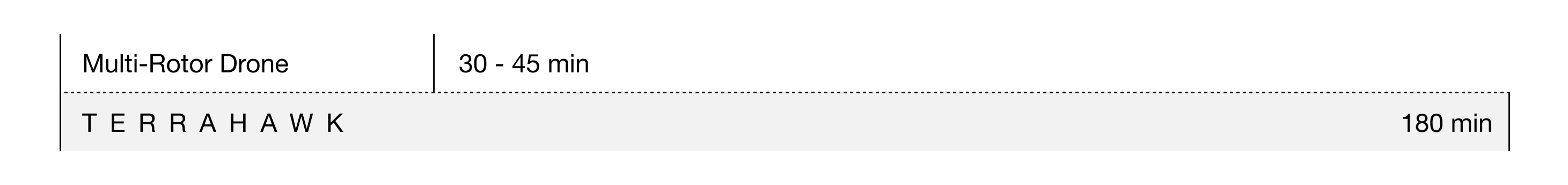
Flight Endurance
Flight Range
Area Mapped
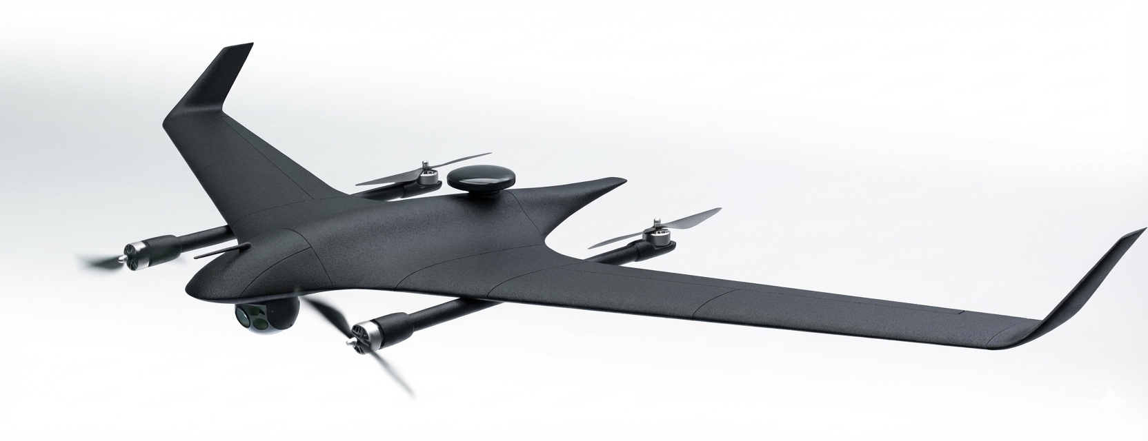
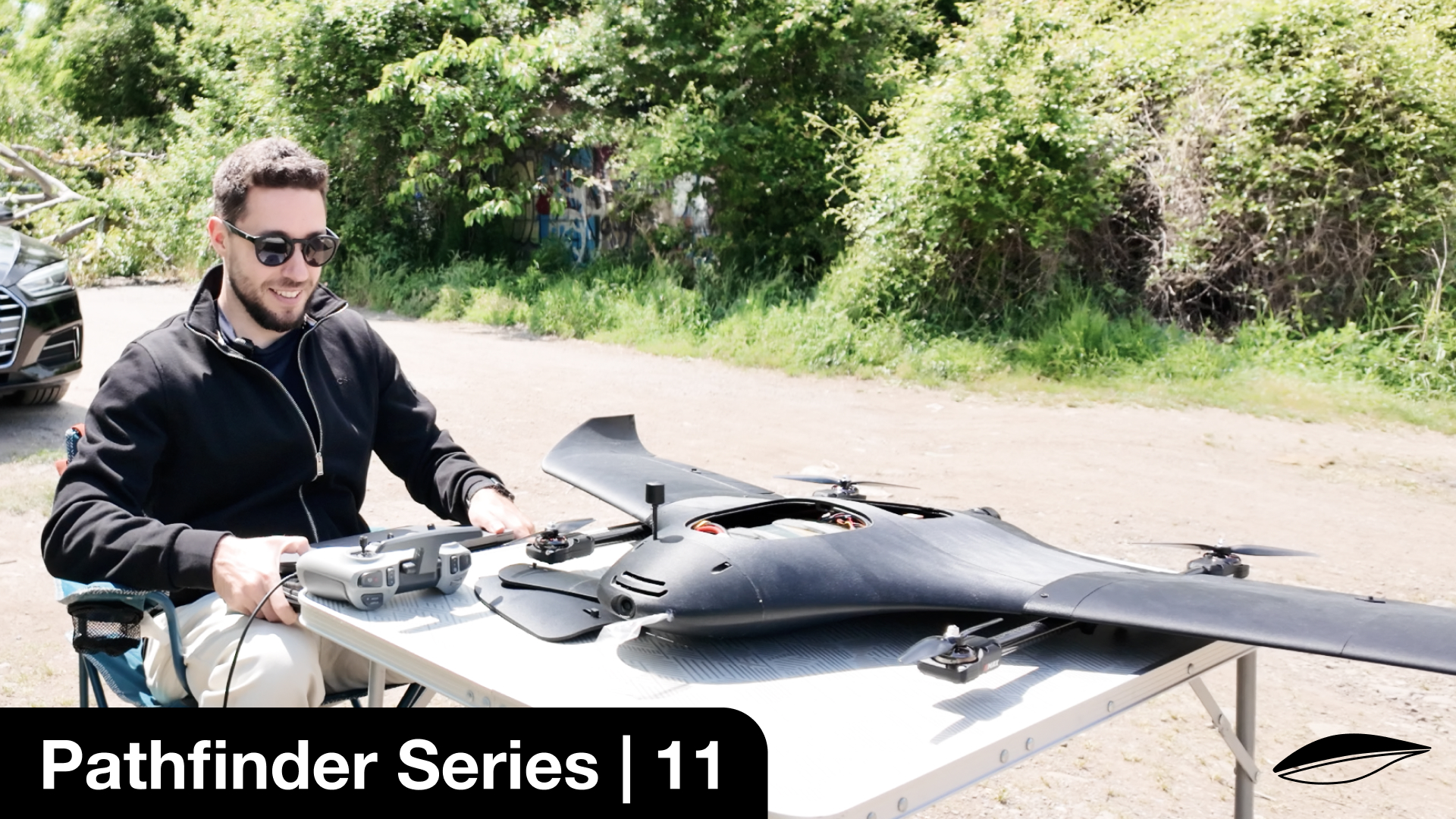
Wingspan
Flight Speed
(16-17 m/s)
AUW
(C2 Class)
Our "Spotlight" payload system features a Dual Optical/IR Gimbal Sensor combined with an onboard AI compute module to enable advanced object recognition, imaging and tracking capabilities, necessary to perform autonomous inspections.
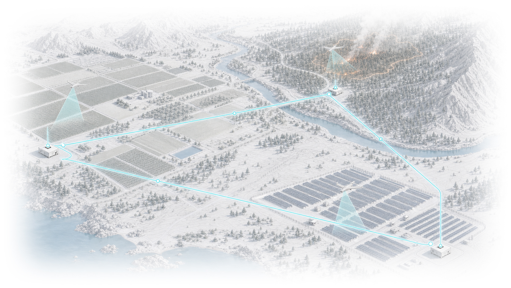
- Solar Parks
- Power Lines
- Pipelines
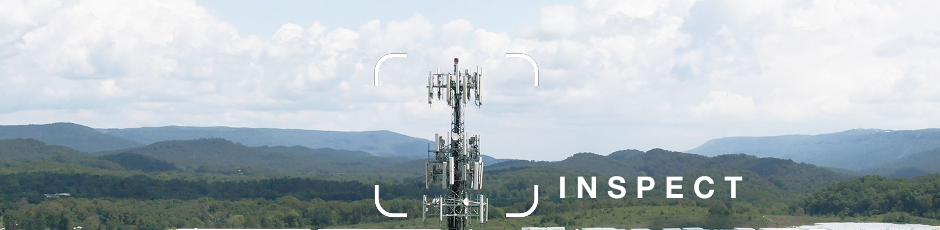
- Cell Towers
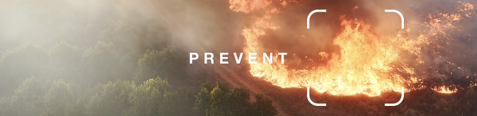
- Wildfire Detection
- Illegal Dumping
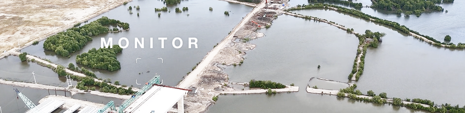
- River Scans to prevent floods
- Dams, reservoirs and pipelines
- Site progress
- Security
- Logistics
- Railways
- Highways
- Ports
- Find Missing People
- Coordinate Rescue Efforts
- Prevent Poaching
- National Border Security
- Personal Property Security
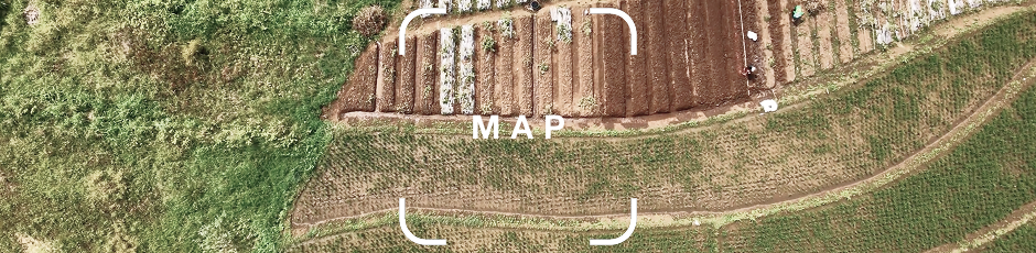
Map up to 10 km2 per flight with a variety of mapping cameras - ADTi 24MP, Sony LR1 (61MP), as well as multi-spectral sensors.
- Precision Photogrammetry
- RTK/PPK Support
- Onboard GeoTagging
- Monitor crop health & irrigation with multi-spectral analysis
We can integrate your own hardware into TerraHawk or you can purchase a TerraHawk without a payload, giving you complete flexibility to protect our ecosystems and communities.
- Up to 1000 grams
- 120x90x70mm (subject to change)
- 5/12/24V power supplied
Control TerraHawk by setting waypoints and updating them in real-time, from SkyHub's web interface - the autopilot will handle the rest.
Fly from anywhere via 4G Cellular. Satellite Comms enable you to resume, pause or retire the mission, if cellular networks fail.
Prevents head-in collisions and flying below safe altitude.
- Triple-Redundant IMUs (Avionics)
- Double-Redundant Flight Modes*
- Emergency Prachute
Resistant to dust and light rain.
Advanced Airframe Materials can withstand up to 100 degrees Celsius.
600 G Payload
Hands-on support from our team
Discounts for TerraHawk Pro
Flight Insurance included
The Developer Kit is not a certified UAV, but can legally be used for R&D, as well as Police, Military, Customs, Search and Rescue, Firefighting, Border Control, Coastguard or similar activities that are exempt from EU civil aviation regulations under Regulation (EU) 2018/1139 Article 2(3)(a).
600 G Modular Payload
C2 Certified UAV (Open A2)
IP54 Rated
Flight Tested in Various Scenarios
Certified for A2 Open and/or STS-02 (BVLOS) operations. Licensed pilot required.
We integrate SIYI, NextVision and other sensors per your needs
Spotlight AI Computer enables the gimbal sensor to capture specific points of interest needed for fly-by inspections.
We integrate ADTi, Sony and other sensors per your needs
Ground Station RTK Module Sold Separately.
We integrate SIYI, NextVision and other sensors per your needs
Custom Payloads Supported.
Based on 4G Cellular and Satellite Connectivity.
Supports live video stream via 4G.
Sim Card sold separately.
Suitable for most commercial use-cases, away from jammed enviroments, including BVLOS operations.
Satellite Comms incur extra costs only during Cellular downtime (~€0.6/min)
We will integrate SIYI MK15, SIYI RC10 Pro and other RC's per your needs.
Supports live video.
Suitable for most operations within a 40km range, away from jammed environments.
- Airframe replacement
- Repairs and component replacements
- Priority support
- Yearly maintenance and firmware updates
- SkyHub Subscription for cloud-based mission control
- Satellite comms costs during cellular downtime
- Water damage
- Incidents due to negligence or critical user error
- Lost or unrecoverable aircraft (50% discount applicable towards a new purchase)
All prices are in Euro, without VAT.
Everything you need to fly - a TerraHawk, a carry case, a battery charger, a user manual and the selected mission control and payload combo.
We've invested significant efforts to design an in-house production process that leverages additive manufacturing (3d printing) using the world's most advanced, military-grade filaments. This process enables us to build very competitive airframes at a fraction of the time and cost of composites (fibreglass) - ultimately making TerraHawk accessible to small businesses, professionals and remote communities.
We're aiming to certify TerraHawk as a C2 and C6 UAV in 2026. Any certified drone pilot for those categories will be able to fly in A2 Open and STS-02 scenarios. Some scenarios like Police, Military, Customs, Search and Rescue, Firefighting, Border Control, Coastguard or similar activities are excempt from EU civil aviation regulations under Regulation (EU) 2018/1139 Article 2(3)(a).
1. TerraHawk comes with a limited 1-year warranty. In the event of a crash, we analyse the flight logs leading up to it and decide on how to proceed.
2. We highly recommend you opt-in for the TerraHawk Insurance Plan - giving you peace of mind and a few additional benefits.
3. If the issue falls outside of the above, we offer replacement parts and rebuilding services at very reasonable prices, to get you back up in the air in no-time.
Contact us anytime!
"The most important job we can assign silicon-based intelligence
is to preserve and spread biological life." - George P., Founder